Skip to: main navigation | main content | sitemap | accessibility page


Point Cloud Scanning

Capturing data to make informed decisions

Our digital surveys include a comprehensive data capture service using the latest 3D laser scanning technologies. Point Cloud Scans allows us to virtually map everything from large scale plants to the smallest of industrial components.


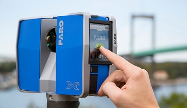
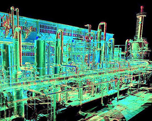
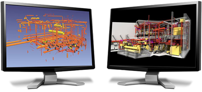
We use our own scanners to keep costs to a minimum as third party hire can add considerable expense to a project. Our suite of high-end equipment combined with our technical expertise enable us to produce extensive yet highly detailed scans.

3D Scanners

We use a range of 3D scanners each with different capabilities, ranges, speeds and accuracies.


When a site or an item is scanned, a highly accurate 3D data set known as a point cloud is generated.

Highlights

  • Fast data capture
  • Accurate (sub mm)
  • Unobtrusive
  • Suitable for hazardous environments
  • Reduces the need for repeated site visits
  • Stunning visual results in 3D

Point Cloud Scan Outputs

  • ‘As Built’ basic layout Autocad or similar
  • ‘As Built’ layout including all pipe runs
  • 3D buildings walls in Autocad exportable to REVIT
  • Photographic 3D ‘walk-throughs’ with instant measurement
  • 3D structural steelwork in Autocad for analysis
  • ‘Shrink-wrap’ 3D modelling direct from Point Cloud
  • 3D pipework modelling with auto export to Plant 3D or PI&D’s
  • Parametric 3D models in dwg, dwf, stp, sat, egs etc
  • Intelligent P&ID’s
  • New pipework ISOGENS
  • Training / Plant investigation
  • Reverse Engineering
3d laser scanning
3d laser scanning

Other services

Automate smarter with our services.